

Drones in Construction: 10 Practical Applications on Indian Sites
The construction industry in India is undergoing a technological revolution, and drones are at the forefront of this transformation. From large infrastructure projects in Mumbai and Bangalore to residential complexes across Delhi and Hyderabad, unmanned aerial vehicles (UAVs) are reshaping how construction projects are planned, executed, and monitored. With India's construction sector projected to grow at 8-10% annually, the adoption of drone technology has become not just an advantage but a necessity for forward-thinking construction firms.
Drones offer unprecedented capabilities for site surveying, progress documentation, safety monitoring, and project management. They reduce costs, minimize risks, and provide real-time data that helps project managers make informed decisions. In this comprehensive guide, we'll explore 10 practical applications of drones on Indian construction sites and how they're revolutionizing the way we build.
Build cost · Bengaluru, May 2026
1. Aerial Site Surveying and Mapping
Before any construction begins, accurate site surveying is crucial. Traditionally, this process involved ground-based surveys that were time-consuming and sometimes inaccurate. Drones have transformed this landscape entirely.
How it works: Equipped with high-resolution cameras and LiDAR sensors, drones can capture detailed aerial imagery of construction sites in minutes rather than days. This data is processed using specialized software to create orthomosaic maps and 3D models of the site.
Indian context: For large infrastructure projects across Bangalore, Chennai, and Pune, drone surveying has reduced surveying time by 60-70% and costs by 30-40%. Projects like metro extensions and highway construction benefit significantly from this technology. A typical drone survey of a 50-hectare site that would take 2-3 weeks using traditional methods can now be completed in a single day for approximately ₹50,000-₹1,00,000.
Key benefits:
Rapid data collection with minimal ground disturbance
High-accuracy topographical maps for planning and design
Early identification of site constraints and challenges
Reduced need for manual surveying equipment and personnel
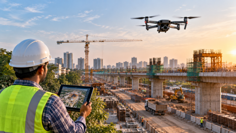
2. Real-Time Construction Progress Monitoring
Project managers need constant visibility into construction progress. Drones provide this visibility with remarkable efficiency.
How it works: Regular drone flights (daily, weekly, or monthly) capture consistent aerial footage of the construction site, allowing project managers to track progress against planned schedules. Time-lapse videos created from drone imagery provide stakeholders with clear visual documentation of project advancement.
Indian application: On multi-story residential and commercial projects in Gurugram, Mumbai, and Hyderabad, weekly drone surveys have become standard practice. These flights cost approximately ₹5,000-₹10,000 per visit but save significantly on delays by catching issues early. A major real estate developer in Pune reported that drone-based progress monitoring helped identify a 2-week delay in structural work within 3 days, allowing for corrective action.
Key benefits:
Objective documentation of project progress
Early detection of scheduling issues
Improved client communication and confidence
Reduced need for site visits by remote stakeholders
Better resource allocation based on actual progress
3. Structural and Facade Inspections
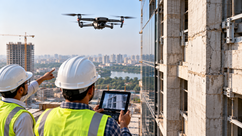
Inspecting tall structures has always been dangerous and expensive. Drones have made this process safer and more efficient.
How it works: Drones equipped with high-resolution cameras and thermal imaging sensors can inspect building facades, roof conditions, structural integrity, and hard-to-reach areas without requiring scaffolding or rope access teams.
Indian relevance: In high-rise construction across Delhi, Mumbai, and Bangalore, drone inspections have become essential. Inspecting a 50-story building facade traditionally required rope access specialists costing ₹2,00,000-₹5,00,000 per inspection. Drone inspections accomplish the same task for ₹30,000-₹75,000. A major construction firm in Mumbai reported identifying critical facade cracks in a 30-story commercial building through drone inspection, preventing potential safety hazards.
Key benefits:
Elimination of safety risks associated with manual inspections
Significant cost reduction compared to rope access teams
Detailed high-resolution imagery for analysis
Faster inspection cycles enabling proactive maintenance
Documentation for warranty and compliance purposes
Frequently asked
4. Safety and Compliance Monitoring
Construction safety is paramount, and drones provide a new dimension to site safety management.
How it works: Drones can monitor site-wide safety compliance, track worker movements in hazardous areas, document safety protocols, and identify potential hazards from a bird's-eye view. AI-powered drone systems can even detect workers not wearing safety equipment.
Indian context: Given India's construction safety challenges, drone-based monitoring has proven invaluable. Projects in Hyderabad, Bangalore, and Delhi have used drones to monitor compliance with safety regulations mandated by the Building and Other Construction Workers Act. One large construction firm reported a 40% reduction in safety incidents after implementing regular drone-based safety audits costing around ₹15,000-₹25,000 per week.
Key benefits:
Continuous safety compliance monitoring
Objective documentation for regulatory compliance
Early identification of safety hazards
Reduced insurance premiums and liability
Improved worker safety culture
5. Volume Measurement and Stockpile Management
Accurate material management is critical for construction cost control. Drones excel at measuring material volumes.
How it works: Drones equipped with LiDAR or photogrammetry capabilities can precisely measure the volume of material stockpiles (sand, cement, aggregates, excavated earth) without manual measurement. Specialized software calculates volumes from drone data with accuracy rates exceeding 95%.
Indian application: Construction sites across India typically waste 5-10% of materials due to inaccurate volume tracking. For a ₹100 crore project, this translates to ₹50-₹100 lakhs in losses. Drone-based volume monitoring, costing ₹20,000-₹40,000 per survey, has helped major contractors in Bangalore and Mumbai reduce material waste by 30-40%. This is particularly valuable for infrastructure projects with massive aggregate requirements.
Key benefits:
Accurate material inventory tracking
Reduced material waste and theft
Better procurement planning
Improved cost control and profitability
Faster material billing and reconciliation
6. Environmental and Geotechnical Site Assessment
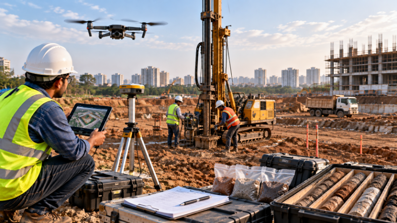
Understanding site conditions is essential before construction begins. Drones provide valuable environmental data.
How it works: Drones with multispectral cameras can assess soil conditions, vegetation, water bodies, drainage patterns, and environmental sensitivity. This data helps in planning drainage systems, identifying environmental concerns, and assessing geotechnical risks.
Indian relevance: For projects in flood-prone areas of Assam, coastal regions of Tamil Nadu and Gujarat, or hilly terrain of Himachal Pradesh, drone-based environmental assessment has become crucial. These assessments help prevent costly mistakes and environmental violations. A major infrastructure project in the Western Ghats region used drone surveys to identify critical environmental zones, saving the project from regulatory delays worth several crores.
Key benefits:
Comprehensive environmental baseline assessment
Early identification of environmental risks
Better drainage and water management planning
Regulatory compliance and documentation
Risk mitigation before project commencement
7. Thermal Imaging for Quality Control
Quality assurance is critical in construction. Thermal imaging drones add a new layer of quality control.
How it works: Drones equipped with thermal cameras can detect temperature variations that indicate structural issues, poor insulation, water infiltration, or electrical problems. This technology is particularly useful for identifying defects that aren't visible to the naked eye.
Indian application: In the energy-efficient building sector growing across Bangalore, Pune, and Hyderabad, thermal drone inspections help verify insulation quality and identify thermal bridges. A green-certified building project in Bangalore used thermal imaging to identify inadequate insulation in 15% of the building envelope, leading to corrective measures before handover. The inspection cost approximately ₹40,000 but prevented potential warranty claims exceeding ₹50 lakhs.
Key benefits:
Detection of hidden defects and quality issues
Verification of insulation and weatherproofing
Early identification of structural problems
Prevention of costly rework and warranty claims
Improved building performance and energy efficiency
8. Site Accessibility and Logistics Planning
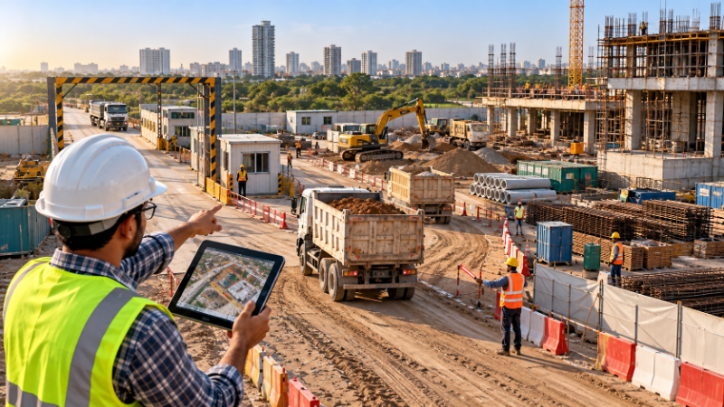
Planning site logistics is complex, especially for constrained urban projects. Drones provide valuable insights for logistics optimization.
How it works: Drones can map site boundaries, identify access points, plan material delivery routes, and assess parking and staging areas. This data helps logistics teams optimize site operations and reduce congestion.
Indian context: In congested cities like Mumbai, Delhi, and Bangalore, construction site logistics are incredibly challenging. A major commercial project in Mumbai's central business district used drone surveys to identify optimal material delivery routes and staging areas, reducing site congestion and improving traffic flow. This optimization saved approximately ₹10 lakhs per month in logistics costs.
Key benefits:
Optimized site access and material delivery routes
Reduced site congestion and traffic impact
Better utilization of site space
Improved coordination with municipal authorities
Reduced logistics costs and delays
9. Documentation and As-Built Records
Comprehensive project documentation is essential for handover and future maintenance. Drones create detailed as-built records.
How it works: Drones capture high-resolution aerial imagery and create orthomosaic maps and 3D models at various construction stages. This documentation serves as a comprehensive as-built record for future reference, maintenance, and modifications.
Indian application: Real estate projects across India increasingly use drone-based documentation for handover purposes. A major residential project in Gurugram created complete drone-based 3D models of the building and infrastructure at various stages, providing buyers and facility managers with detailed documentation. This level of transparency reduced post-handover disputes by 60% and improved customer satisfaction scores.
Key benefits:
Comprehensive as-built documentation
Reference for future maintenance and modifications
Improved handover transparency
Reduced post-handover disputes
Better facility management capabilities
10. Marketing and Stakeholder Communication
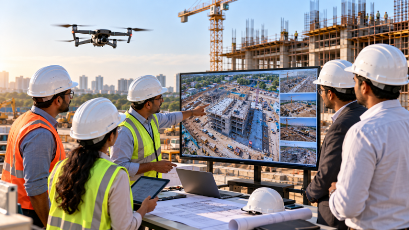
In today's competitive real estate market, drone footage has become a powerful marketing tool.
How it works: Drone footage and aerial imagery are used to create compelling marketing materials, project videos, and progress updates. This visual content helps sell properties, attract investors, and keep stakeholders engaged.
Indian relevance: Real estate developers across Bangalore, Hyderabad, and Mumbai have successfully used drone-based marketing materials to increase property sales. A luxury residential project in Bangalore reported a 35% increase in inquiries after launching drone-based project videos on their marketing channels. The production cost of approximately ₹2,00,000 for professional drone videography generated returns exceeding ₹5 crores in additional sales.
Key benefits:
Professional project presentation
Increased buyer interest and engagement
Enhanced investor confidence
Competitive differentiation in the market
Improved project visibility and brand value
Regulatory Considerations for Drone Operations in India
While drones offer tremendous benefits, it's important to understand India's regulatory framework. The Directorate General of Civil Aviation (DGCA) has established guidelines for drone operations:
Licensing: Drone pilots must obtain a Remote Pilot License (RPL) from the DGCA
Permissions: Flight operations in restricted airspace require specific permissions from aviation authorities
Flight altitude: Drones typically operate below 120 meters AGL (above ground level)
Insurance: Operators should maintain comprehensive drone insurance
Privacy: Drone operations must comply with privacy regulations and obtain necessary clearances
When sourcing drone services, ensure your provider complies with all DGCA regulations and holds necessary certifications.
Cost-Benefit Analysis for Indian Projects
The ROI for drone technology varies by project type and scale:
Large infrastructure projects (₹100+ crores): Drone investment typically pays for itself within 3-6 months through improved efficiency and cost savings.
Medium commercial projects (₹20-100 crores): ROI achieved within 6-12 months through reduced inspection costs and improved project management.
Residential projects (₹10-50 crores): Benefits include better progress tracking and marketing value, with ROI in 12-18 months.
Small projects (below ₹10 crores): Selective use of drone services for specific applications (surveying, inspections) provides targeted cost benefits.
Finding Drone Service Providers on AECORD
If you're planning to integrate drone technology into your construction project, finding qualified professionals is crucial. AECORD, India's leading B2B2C marketplace for AECO professionals, connects you with experienced drone service providers who specialize in construction applications. Whether you need surveying, progress monitoring, inspections, or specialized imaging, AECORD's network of certified professionals can meet your specific requirements.
The platform allows you to compare providers, review their expertise, and connect with specialists who understand the Indian construction landscape and regulatory requirements.
Future Trends in Construction Drone Technology
The drone technology landscape is evolving rapidly. Emerging trends include:
AI-powered analysis: Automated defect detection and progress analysis
Autonomous operations: Self-flying drones following pre-programmed routes
Extended flight times: Hybrid and electric drones enabling longer operations
5G integration: Real-time data transmission for remote monitoring
Specialized payloads: Advanced sensors for specific construction applications
Conclusion
Drones have transitioned from novelty technology to essential tools on Indian construction sites. The 10 applications outlined in this article—from surveying and progress monitoring to safety compliance and marketing—demonstrate the transformative potential of UAV technology in the construction industry. With costs becoming increasingly competitive and regulatory frameworks becoming clearer, drone adoption is set to accelerate across Indian construction projects of all scales.
Whether you're managing a large infrastructure project in Mumbai, a commercial development in Bangalore, or a residential complex in Hyderabad, drone technology can significantly improve efficiency, reduce costs, and enhance safety. The key is to partner with qualified professionals who understand both the technology and the Indian construction environment.
Ready to integrate drone technology into your construction project? Connect with certified drone service providers on AECORD today. Browse our network of professionals specializing in construction surveying, progress monitoring, inspections, and project documentation. Find the right expertise for your specific project needs and take your construction management to new heights.
Frequently Asked Questions
How much time and cost can drones save on construction site surveying in India?
Drones can reduce surveying time by 60-70% and costs by 30-40% compared to traditional methods. A 50-hectare site survey that typically takes 2-3 weeks can now be completed in a single day for approximately ₹50,000-₹1,00,000.
What are the main applications of drones on Indian construction sites?
Drones are used for aerial site surveying and mapping, real-time progress monitoring, structural and facade inspections, safety monitoring, and project documentation. They provide high-resolution imagery and 3D models that help project managers make informed decisions and catch issues early.
How do drones help with construction progress monitoring?
Regular drone flights capture consistent aerial footage and create time-lapse videos that track construction progress against planned schedules. Weekly drone surveys typically cost ₹5,000-₹10,000 per visit and help identify delays within days, enabling quick corrective action.
What technology do construction drones use for site surveying?
Construction drones are equipped with high-resolution cameras and LiDAR sensors that capture detailed aerial imagery processed using specialized software to create orthomosaic maps and accurate 3D models of construction sites.
Why is drone technology becoming necessary for Indian construction firms?
With India's construction sector projected to grow at 8-10% annually, drone adoption has become essential for forward-thinking firms to reduce costs, minimize risks, provide real-time data, and improve project management efficiency on large infrastructure projects.